 The Meeting(s) will take place on 4-5 September 2008
Saturday, August 30, 2008
Friday, August 29, 2008
Successful Workshop devoted to local/thematic SDI evaluation

 eSDI-Netplus Workshop in Budapest on 29 August
Program completed:
8:55 Welcome address given by Barkóczi, Zsolt President of HUNAGI
9:00 Territorial Information System (TeIR) presented by Juhász, P. Géza, VÁTI
URLs (homepages and reference):
http://teir.vati.hu
http://terport.vati.hu
http://www.vati.hu
Discussion contributors: dr. Mihály, Szabolcs (FÖMI), dr. Remetey-Fülöpp, Gábor (HUNAGI)9:30 National Technical and Executive Information System for public Roads (KOMVIR) presented by Radnóthy, Csaba, CIO, Hungarian Roads Management Company
Discussion contributors: Lévai, Pál (FÖMI), dr. Alabér, László (DoD Mapping Company), dr. Mihály, Szabolcs (FÖMI)
10:00 MÉTA Database Service and Landscape Ecological Vegetation Atlas of Hungary presented by Dr. Horváth, Ferenc Institute of Ecology and Bottany
URLs homepage and references:
https://msw.botanika.hu/meta/meta_a_vilaghalon_EN.htm
Discussion contributors: Cservenák, Róbert (HungaroCAD), Juhász, P. Géza (VÁTI), Ferencz, Viktória (VÁTI), dr. Mihály, Szabolcs (FÖMI), dr.Remetey-Fülöpp Gábor (HUNAGI), dr. Martinovich, László (FÖMI)
Discussion contributors: Cservenák, Róbert (HungaroCAD), Juhász, P. Géza (VÁTI), Ferencz, Viktória (VÁTI), dr. Mihály, Szabolcs (FÖMI), dr.Remetey-Fülöpp Gábor (HUNAGI), dr. Martinovich, László (FÖMI)
10:30 The Hungarian National Vineyard GIS Register (VINGIS) presented by dr. Martinovich, László and dr. Molnár, Attila both FÖMI Remote Sensing Centre. Co-author: Katona, Zoltán FÖMI TK
URL: http://www.fomi.hu (Public website)
11:00 National Ragweed and Allergic Plants Control System (PIR) presented by dr.Martinovich, László. Author: Dr. Mikus, Gábor FÖMI KT Co-authors: Csornai, Gábor and Irén Hubik FÖMI TK
11:00 National Ragweed and Allergic Plants Control System (PIR) presented by dr.Martinovich, László. Author: Dr. Mikus, Gábor FÖMI KT Co-authors: Csornai, Gábor and Irén Hubik FÖMI TK
URL: http://www.fomi.hu (Public website)
11:30 INVATER presented by Cservenák Róbert, HungaroCAD
11:30 INVATER presented by Cservenák Róbert, HungaroCAD
URL: http://www.zalaegerszeg.hu
Discussion contributors: Pogrányi, Károly, dr. Mihály, Szabolcs, Barkóczi, Zsolt
12:00 Information on some follow-on actions and wrap-up given by dr.Remetey-Fülöpp, Gábor (HUNAGI)
Additional participants: Katona, Zoltán (FÖMI), Mitnyan, Zoltán (graphIT/Intergraph),Pogrányi Károly (HungaroCAD/Autodesk), Virágh, Hajnalka (HungaroCAD), Oláh, Attila, (ESRI Magyarország), Beke, Dániel (ESRI Magyarország).
Apologies were received from: Gabriella Szomolaiova (Intergraph, Slovakian eSDI-Net+ contact), Takács, Ferenc (Zalaegerszeg City Municipality), dr. Mikus, Gábor (FÖMI), Prof. dr. Márkus, Béla (UWH Faculty of Land Management and Geoinformatics) All of the six local/thematical SDI were recommended to take part on the European-level evaluation contest within the framework of the Working Package 2 of the eSDI-Net+ project (an EU eContent program). Registration should be completed on-line by the representatives of the selected systems before 20 September. The early Hungarian experiences related to the use of the Evaluation methodology elaborated by EUROGI in 2008 will be shared at the Project Consortium Meeting hosted by the La Sapienza University in Rome on 11-12 September.
Discussion contributors: Pogrányi, Károly, dr. Mihály, Szabolcs, Barkóczi, Zsolt
12:00 Information on some follow-on actions and wrap-up given by dr.Remetey-Fülöpp, Gábor (HUNAGI)
Additional participants: Katona, Zoltán (FÖMI), Mitnyan, Zoltán (graphIT/Intergraph),Pogrányi Károly (HungaroCAD/Autodesk), Virágh, Hajnalka (HungaroCAD), Oláh, Attila, (ESRI Magyarország), Beke, Dániel (ESRI Magyarország).
Apologies were received from: Gabriella Szomolaiova (Intergraph, Slovakian eSDI-Net+ contact), Takács, Ferenc (Zalaegerszeg City Municipality), dr. Mikus, Gábor (FÖMI), Prof. dr. Márkus, Béla (UWH Faculty of Land Management and Geoinformatics)
Dr.Szabolcs Mihály, Director General of FÖMI, Zsolt Barkóczi, President of HUNAGI and Géza P. Juhász, GIS expert of VÁTI. Images: HUNAGI Visuals Resource, 2008
All of the six local/thematical SDI were recommended to take part on the European-level evaluation contest within the framework of the Working Package 2 of the eSDI-Net+ project (an EU eContent program). Registration should be completed on-line by the representatives of the selected systems before 20 September. The early Hungarian experiences related to the use of the Evaluation methodology elaborated by EUROGI in 2008 will be shared at the Project Consortium Meeting hosted by the La Sapienza University in Rome on 11-12 September.UNSDI HUCO blog visited by professionals from all over the World.

Since 25 October 2007 HUCO website was visited nearly 10 thousand times from over 100 countries . Past 15 entries includes visitors from Purdue University, FAO, USGS, NLR, ESRI and Magyar Közút, a public benefit company for the management of 33,000 km public roads in Hungary
28.08.08 19:01:55 | Purdue university | United States of America |
28.08.08 20:08:40 | For network expansion and subscriber .. | United Kingdom |
28.08.08 20:16:27 | Not available | United States of America |
28.08.08 21:38:14 | U.s. geological survey | United States of America |
29.08.08 01:28:23 | Environmental systems research instit.. | United States of America |
29.08.08 09:16:19 | Food and agriculture organization of .. | Italy |
29.08.08 11:27:36 | Cpe customers nl | Netherlands |
29.08.08 13:23:00 | Magyar kozut kht. | Hungary |
29.08.08 13:26:07 | Small customers | Romania |
29.08.08 13:53:15 | Vemer-sibergroupspa | Italy |
29.08.08 14:46:27 | Invitel tavkozlesi szolgaltato rt. | Hungary |
29.08.08 15:59:40 | National aerospace laboratory | Netherlands |
29.08.08 16:59:11 | Telfort internet | Netherlands |
29.08.08 19:41:37 | Telefonica de espana (ncc#2006112951) | Spain |
29.08.08 20:12:05 | Org_unit_en: gts-datanet telecommunic.. | Hungary |
Wednesday, August 27, 2008
Franz Leberl introduced Microsoft Photosynth at the GISS 2008 in Székesfehérvár

Prof. Dr. Franz Leberl, Dean of the Graz University of Technology, chief scientist of Microsoft Virtual Earth presented among others the just released Photosynth product of Microsoft at the GISS 2008 Conference arranged and hosted by Prof. Dr. Béla Márkus of the University of West Hungary in Székesfehérvár. The Photosynth system (http://photosynth.com) will be fully integrated with the Microsoft Virtual Earth (http://maps.live.com) and an OS friendly version will be available soon for the Mac users.
Amazing lectures at the GISS 2008
Urban 3D Modeling presented by Lajos Kandra of Burken Ltd, distributor for Riegl


Prof. Dr. Franz Leberl delivered a remarkable lectures devoted to the Virtual Earth Vision's implementation
Sunday, August 17, 2008
HUNGEO 2008 with active HUNAGI participation

IXth World Meeting of the Hungarian Geoscientists
Budapest, 20-24 August, 2008
HUNAGI presentation scheduled for 22 August will focus on the importance of domestic and international cooperations, frameworks and spatial data interest community building. For more information please visit: http://lazarus.elte.hu/hun/
The Meeting will be hosted by ELTE, the Eötvös Loránd University of Sciences in Buda. Image: HUNAGI Visuals resource, 2002


Microsoft sponsored 3D Conference in Hungary


International Conference on 3D data collection and modeling
University of West Hungary Faculty of Geoinformatics, Székesfehérvár, Hungary, 27 August 2008
The following information was kindly provided by Prof. Dr. Márkus Béla of UWH Faculty of Geoinformatics :
In framework of UNIGIS (www.unigis.hu) a one-week Summer School devoted to the topic „Urban 3D modelling” will be organised by UWH GEO (www.geo.info.hu) starting by 23 August. The course will be attended by 40 students from abroad and 10 from Hungary. For 27 August, a one-day conference has been arranged by the host organiser in order to give an overview on new methodologies in data collection and modeling in the field of the human settlements. Issues addressed include advanced technologies in photogrammetry, and practical implementation of aerial laser scanning and 3D spatial visualisation. The venue is the UWH GEO's Knowledge Center on Land Management and Geoinformation. Lectures will be delivered by some leading representatives of the 3D arena including top experts of Eurosense, LEICA, Varinex, Laservision/Riegl, YonaPMS, FIG Commission 7 as well as Prof. Franz Leberl, chief scientist of Microsoft' Virtual Earth program. The event has zero registration fee thanks to the prominent donor organisations. Major sponsor of the conference is Microsoft. Working language will be English. Details: www.geo.info.hu HUNAGI advised the host and main organiser to offer one or more papers of the high-profile presentations for the International Journal of Digital Earth for publication. Also Editor-in-Chief Prof. John Genderen will be informed accordingly.
Program:
Earlier this year, Prof. Béla Márkus clearly indicates their interest to be involved in the implementation of the UNSDI and provided contribution via UNSDI HUCO related to the package "Capacity building"
Thursday, August 07, 2008
Evaluation of some spatial data services in Hungary
Interviews within the eSDI-Net+ programme completed. Evaluated services include:
ZEGVATER Zalaegerszeg Municipality Asset Cadastre and Information System
VINGIS Vineyard Registry
PIR
TeIR/TérPORT
MÉTA
KOMVIR
More details will be given soon
ITC Education Programme for 2009-2010
ITC Headquarters in Enschede, The Netherlands. Image: HUNAGI Visuals resource, 1999
From our daily mail.

From our daily mail.
Degree, diploma and certificate programmes in Geo-information Science and Earth Observation at ITC, Enschede
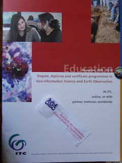
Details: www.itc.nl/education
Subscribe to:
Posts (Atom)