Followers

Sunday, May 31, 2009

GINNT EXPO 2009

Europa Congress Center. Image: HUNAGI Visuals resources, 2009
GINNT Expo with selected eSDI-Netplus posters and round-table discussion on spatial data and their infrastructure. Participants include
June 11, 2009 2-3 pm:
Bozó, Pál Deputy Director General of Informatics, Ministry of Environment and Water, Member of the European INSPIRE Committee
Tóth, Sándor Deputy Director General, Department of Land Administration and Geoinformation,
Dr. Mihály, Szabolcs Director General, Institute of Geodesy, Cartography and Remote Sensing (FÖMI), Chair, WG on Geoinformatics, Hungarian Standardisation Board
Lelkes, Miklós Head of Main Department, Directorate of Direct Subsidies, Office of Agriculture and Rural Development
Szabó, Richárd Chair, Division of Geoinformatics, Scientific Association for Management and Organisation, Managing Director of GeoLevel Ltd
Moderator: Barkóczi, Zsolt President of the Hungarian Association for Geo-information

Friday, May 29, 2009

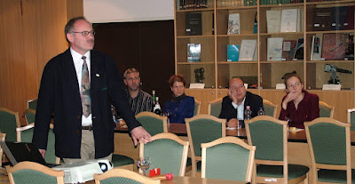
Wines and Maps - Joint Workshop of the MLBKT and HUNAGI

FÖMI hosted the first joint Workshop of the Hungarian Association of Logistics, Purchasing and Inventory Management (MLBKT www.logisztika.hu) and the Hungarian Association for Geo-information (HUNAGI www.hunagi.hu). Opened by Dr. Éva Harbula of FÖMI, the event had two presenters namely senior counsellors Pál Lévai, Head of FÖMI INSPIRE Team and Dr. László Martinovich manager of VINGIS at FÖMI Remote Sensing Centre. Link to the ppts will be available here soon.

Tuesday, May 26, 2009

Poster on the Hungarian thematic SDI VinGIS on display at Jaxa's Remote Sensing Technology Center of Japan.

After the intervention of HUNAGI delegate on behalf GSDI Association at the CEOS WGISS27 held in Toulouse some days ago, RESTEC representative Ms. Shinobu Kawahito expressed her interest on the Hungarian best practices in agricultural applications. As example the VinGIS poster was submitted in e-form. Today the poster hangs in printed form at the Remote Sensing Technology Center of Japan.
She wrote in her e-mail yesterday:
" Dear Dr. Gabor Remetey
It was nice to talk with you at the last WGISS meeting in Toulouse.
Please find photos of the poster you kindly provided me.
http://virgo.tksc.jaxa.jp/restec/photoWithSDIPoster.zip
When I printed it out, my colleague who favors wine mentioned
Hungary is famous for its excellent wine such as TOKAJI wine.
No wonder GIS technology like that VineGIS is practically
operated in Hungary.
In Japan, major crop is paddy. We are now involved in an
agricultural pilot project where GIS and satellite imagery are
used to extract, analyze paddy field. Wheat is a next crop
in our interests.
Thanks very much for the poster and its best practices.
Best regards,
Shinobu Kawahito"
Image courtesy by Shinobu Kawahito of RESTEC, 2009

For more information on VinGIS please click on the header
For more information on FÖMI and its Remote sensing Centre please visit: www.fomi.hu
For more information on RESTEC please visit http://restec.or.jp

Hungarian lecturers at the National Cartographic Centre of Iran in Tehran

Lecturers and course participants. Image courtesy by Prof. L. Zentai, 2009
Short report has been sent by Prof. László Zentai for the visitors of the HUNAGI-UNSDI HUCO blog:
"Thirty participants attended the first two weeks of a hands-on Workshop on Cartography in Tehran, Iran. The workshop, held from 9th to 13th May and from 16th to 20th May 2009, was organised by the National Cartographic Center of Iran and the ICA Commission on Education and Training (CET). The workshop was hosted by the National Cartographic Center (NCC), and in particular staff of the Cartography Department, NCC ICA delegate Babak Shamei, and the deputy manager of the Cartography Department, Mehrdad Jafari. Participants were primarily NCC staff involved in map production associated with the publishing of country maps, city maps, street directories and atlases.

Workshop I
The workshop was presented by the MSIA President, David Fraser and Colin Arrowsmith from the RMIT University, Melbourne.
There were presentations and hands-on sessions on the topics of the Earth's geometry, map projections, topographic maps, map design and cartographic information systems. The workshop focused on the identification of issues and techniques that would assist employees of the NCC in their map design and production. David Fraser used his background in cartography to lead discussion into how the existing NCC map products could be altered to take advantage of sound design principles. Presentations and discussion were backed up with tutorials. Colin Arrowsmith focused his presentations on cartographic information systems and guided the participants through two GIS based practical exercises.

Workshops II
The second part of the workshop was managed by László Zentai (Eötvös University, Budapest) and Antal Guszlev (Nav N Go Ltd., Budapest), the Hungarian members of CET.
The topics were Cartographic information systems (part II), Internet mapping, Atlas production and Prepress & Digital Printing. The Hungarian contributors used their experiences in map publishing and webmapping and organized two groupwork excersises for the participants.

A further one week workshop being presented by David Forrest and Mike Shand from Scotland on the topics of digital generalisation, 3D & geovisualization; multimedia products, location based services, cartographic animation & dynamic maps and navigational maps.

CET is going to organize a similar workshop in Vietnam in November 2010."
Excursion to Isfahan: László Zentai, Colin Arrowsmith, Antal Guszlev with their hosts Mehrdad Jafari and Reza Ahmadyieh (NCC), David Fraser Image courtesy by Prof. Zentai, 2009
More information on the affiliation of the Hungarian experts:
http://www.navngo.com
http://lazarus.elte.hu

Monday, May 25, 2009

Flashback: HUNAGI takes part in global activities

The Hungarian Association for Geo-information (HUNAGI) is a non-for-profit, interdisciplinary, non-governmental umbrella organisation having 101 member institutions and organisations from government, NGOs, academia and private sector.

HUNAGI major objectives are to encourage and facilitate the availability, share, accessiblity and useability of geographic information according to the European spatial data infrastructure-related legislation framework INSPIRE for the benefit of the GI community. HUNAGI is registered and acknowledged as Spatial Data Interest Community at DG JRC of the European Commission.

To achieve its goals HUNAGI focuses on partnership with the major stakeholders and governmental agencies involving end users via dissemination of best practices mainly gained in multilevel international cooperation on European (EUROGI) and global level (Global Spatial Data Association, International Society of Digital Earth and UNGIWG).

As member of the GSDI Delegation HUNAGI took part the GEO IV (November 2007) and GEO V plenary (November 2008) meetings and assisted in the preparations of interventions and statement. HUNAGI liaison represented GSDI Association at the 26th Meeting of the CEOS Working Group on Information Systems and Services and joint WGISS and GEO committee workshop hosted by UCAR in Boulder (June, 2008).

HUNAGI was invited to the National Committee for the UNESCO-driven International Year of the Planet Earth and mobilised some of its member institutions from the geoscience community to exhibit their activities at the Hungarian IYPE Conference and Exhibition (April, 2008).

HUNAGI and GSDI representatives co-chaired the Sessions of the 21th ISPRS Congress devoted to Spatial Data Infrastructures (July, 2008) and attended the ISDE Summit the first meeting of professionals in Geoinformatics and Climate Change hosted by the German Geoscience Research Centre in Potsdam (September, 2008).HUNAGI as NGO and the UNSDI HUCO was invited to the 9th Plenary Meeting of the UNGIWG (november, 2008)

Representative of HUNAGI received a seat also in the Hungarian Space Research Council (April, 2009)

Recently - at the 27th Meeting WGISS hosted by CNES in Toulouse between 11-15 May 2009, the HUNAGI delegate representing the Global Spatial Data Infrastructure Association (GSDI) made two contribtions. Firstly advised for the WGISS Best Practices and Lession Learned Interest Grop (lead by NOAA) to contact the European eSDI-Net+ project coordinator to study the methodology developed last year under the leadership of EUROGI in the field of identification and evaluation of best practices for regional and thematic spatial data infrastructures. Secondly, he underlined the critical role of information for decision makers on the availability, accessibility, quality and useability of spatial data in applications which need quick response time. It was suggested, based on the practical experiences of UN-SPIDER and the WGISS members active in the disaster response operational applications (USA, France, Ukraina, China) the GSDI Spatial Data Infrastructure Cookbook Wiki should be extended describing the requirement of these challenging disaster mitigation applications. The proposal was well received by Chair Ms. Martha E. Maiden of NASA and the Head of the SPIDER Bureau in Bonn, Mr. Lóránt Czarán expressed his interest to act accordingly. This issue could be also addressed at the 10th anniversary UN Geographic Information Working Group (UNGIWG) Plenary Meeting in Bonn from 19 to 21 October 2009. It is anticipated that HUNAGI- as civil National GI Association, coordinator and disseminator of UNSDI related information - will be invited again. The findings could be drafted and discussed at the 3rd UN-SPIDER Workshop: “Disaster Management and Space Technology – From Concepts to Application”, which is being jointly organized by the United Nations Office for Outer Space Affairs (UNOOSA) and the German Aerospace Center (DLR) in Bonn, between 21 – 23 October 2009. HUNAGI raises awareness among its members and partners to take part actively at this Workshop.

HUNAGI and UNSDI-HUCO in nutshell


The content of the newest two-sided HUNAGI flyer in English is available at the European Commission's webpage devoted to registered legal entities by clicking on the header. An ECAS account is needed for any inquiry. The steps are easy and well supported.

3rd UN-SPIDER Workshop on Disaster Management and Space Technology and the 10th UNGIWG Plenary in Bonn

Third United Nations International
UN-SPIDER Bonn Workshop:
“Disaster Management and Space Technology From Concepts to Application”

Organised by the United Nations Office for Outer Space Affairs (UNOOSA)
and the German Aerospace Center (DLR)
Bonn, Germany, 21– 23 October 2009
Langer Eugen UN Campus, Hermann-Ehlers-Str. 10

Mr. Joerg Szarzynski of UN-SPIDER wrote to HUNAGI/UNSDI HUCO:
"The Third United Nations International UN-SPIDER Bonn Workshop: “Disaster Management and Space Technology – From Concepts to Application”, which is being jointly organized by the United Nations Office for Outer Space Affairs (UNOOSA) and the German Aerospace Center (DLR).
The workshop will be held in Bonn, Germany, from 21 – 23 October 2009 in the UN Building in Bonn.
We are attaching the first announcement of the workshop and we would be grateful if you could forward the announcement to colleagues that would benefit from participating.
We are also planning the following meeting which is being organised back-to-back with the Third International Bonn Workshop: UN Geographic Information Working Group (UNGIWG) 10th (Anniversary) Plenary" in Bonn,
Germany, 19 to 21 October 2009.
We would highly welcome your participation within the workshop.
We also maintain a Calendar of Events with upcoming Conferences, Meetings and Events relevant to the area of space-based solutions for disaster management and emergency response."
For further information, please click on the header.

Saturday, May 23, 2009

Latest information on the coordination of space-related activities within the United Nations system

From our daily mail:
According to the recent SPIDER-list based communication of Mr. Werner Balogh, Programme Officer of the Committee Services and Research Section at the Office for Outer Space Affairs (OOSA) of the United Nations Office at Vienna (UNOV) the UN reports of the recent 29th Session of the United Nations Inter-agency Meeting on Outer Space Activities, which serves as the focal point for United Nations inter-agency coordination and cooperation in space-related activities, have been released.
The reports provide the latest information on the coordination of space-related activities within the United Nations system.
They are available, in all official languages of the United Nations, from the website for United Nations Coordination of Outer Space Activities (UNCOSA website) at http://www.uncosa.unvienna.org/. The direct links to these reports are listed below:
Report of the United Nations Inter-Agency Meeting on Outer Space Activities on its twenty-ninth session (A/AC.105/939)
URL: http://www.uncosa.unvienna.org/uncosa/en/reports/index.html#AC105_939
Coordination of space-related activities within the United Nations system: directions and anticipated results for the period 2009-2010 (A/AC.105/940)
URL: http://www.uncosa.unvienna.org/uncosa/en/reports/index.html#AC105_940
In addition, all meeting documents of the 29th Session of the Inter-agency Meeting have now been posted at
http://www.uncosa.unvienna.org/uncosa/en/iamos/index.html.
UN OOSA hopes that you will find the information contained in these reports and available from the UNCOSA website helpful.
For further information contact the respective United Nations entities (for contact information see
http://www.uncosa.unvienna.org/uncosa/en/directory/index.html) or the Secretariat of the Inter-agency Meeting at oosa@unoosa.org.

Tuesday, May 19, 2009

Workshop on Geomarketing organised by the Geoinformation Division of the Hungarian Society of Management and Organisation

Some of the participants of the postgraduate students and junior experts. Image: HUNAGI Visuals resource, 2009

The event was organised by Mr. Richard Szabó, Chair of the SZVT Division of Geoinformation, Invited speakers (including 4 HUNAGI member rganisations and institution (Geodézia Zrt, GeoLevel Ltd, Varinex Ltd and FÖMI) addressed the issue geomarketing from different aspects: geomarketing needs on geo-information, geomarketing geodata in AM/FM environment, geomarketing in education, eLearning and distance learning, geomarketing and the intelligent village, HUNAGI strategic links in the Euro-atlantic dimension in the context, geomarketing software for analysis and visualisation.

Monday, May 18, 2009

GEO News (Issue #3, 18 May 2009)

From our daily mail: Martha E. Maiden, Chair of the CEOS WGISS submitted the information today:
GEO News (Issue #3, 18 May 2009)
See GEO News on the web at http://www.earthobservations.org/pr_gnl.shtml

"GEO News (Issue #3, 18 May 2009)
BUILDING GEOSS
AEGOS strengthens GEOSS coverage of georesources
By Stuart Marsh, British Geological Survey
Although georesources do not constitute a GEO Societal Benefit Area (SBA), their inclusion in GEOSS is essential. Not only is the Earth’s sub-surface an integral part of the Earth system, but georesources – which range from minerals to underground water supplies to geothermal energy – are relevant to several existing SBAs and thus demonstrate the cross-cutting nature of GEOSS. The recent launch of the African European Georesources Observation System (AEGOS), therefore, promises to both broaden and strengthen GEOSS. Continued...

Remote-sensing community embraces GEOSS at ISRSE-33
The Northern Italian city of Stresa welcomed the world’s remote-sensing community to the 33rd International Symposium of the Remote Sensing of the Environment (ISRSE-33) from 4 to 8 May. The event highlighted the increasingly strong commitment that space agencies and other remote-sensing organizations have to the successful implementation of GEOSS. Continued...

Comprehensive Land Surface Imagery now available via GEOSS
In another exciting advance for the Global Earth Observation System of Systems (GEOSS), ten leading space-related agencies collaborating through the Committee on Earth Observation Satellites (CEOS)
, its Land Surface Imaging Constellation Study Team, and its Working Group on Information System and Services (WGISS) have developed a portal that collects and distributes satellite imagery of the Earth’s land surface. Users can now access images from all ten partners via a single web portal . This new portal is a gateway to the world’s largest collection of Land Surface Imagery and data (LSI) taken from space. Read more here .
Landsat archive downloads hit 500,000 mark
On 2 April, the US Geological Survey announced
that the number of remotely-sensed images downloaded free-of-charge from the Landsat archive had already reached 500,000. This compares with the previous record of 25,000 paid downloads for an entire year. The new policy of granting unrestricted access to Landsat archival images was announced by the US at the GEO-V Plenary meeting in November 2008. Together with the free data policy of Brazil’s National Institute for Space Research (INPE), the new US approach to satellite data marks a major advance for the GEOSS Data Sharing Principles. The next important step in improving access to Earth observations will take place when the Data Sharing Principles Task Force, established at GEO-V, holds its first meeting in Geneva on 27-28 May. For more on the Landsat portal, see the earlier GEO web story .
EEA Workshop explores how GEOSS can support MEAs
The European Environment Agency (EEA) organized a workshop in Copenhagen on 13-15 May to address the growing mismatch between the expectations of Multilateral Environmental Agreements (MEAs) and the ability of space- and ground-based Earth observation systems to support them. The workshop focused on strengthening institutional links, promoting sustained funding, and identifying the most relevant data streams and information services. For more information, see www.eea.europa.eu
.
Call for Proposals to support decision making
GEO has issued a Call entitled “Earth Observations in Decision Support Projects” that seeks to identify projects that demonstrate the benefits of Earth observation applications to end users in developing countries, particularly in the fields of agriculture, energy, human health and water. The CFP also seeks to identify individuals and organizations interested in advising project teams. The deadline for submissions of brief concept proposals is 4 June. Details are available on the CFP page
.
GEO UPDATE
Austria joins GEO
The Government of Austria, which until now has participated in GEO as an Observer, became a GEO Member on 9 March. This brings the total GEO membership
to 77 national governments plus the European Commission.
Geneva meeting launches reconciliation process
Following a recommendation of the GEO-V Plenary, the first Reconciliation Meeting was organized in Geneva from 30 March to 1 April. It marked the formal start of the reconciliation process, which seeks to ensure that three key processes – the Targets update, the 2009-2011 Work Plan update, and the GEOSS Monitoring and Evaluation (M&E) framework – are coordinated and take full account of one another. (For more background on this issue, see the earlier GEO News article.) Continued...

Committees update
Three of the GEO Committees (Architecture and Data, Science and Technology, and User Interface) met during the International Symposium for Remote Sensing of the Environment (ISRSE) in Stresa, Italy in May, while the fourth (Capacity Building) met in Athens in April. For a short summary of the main outcomes of these most recent Committee meetings, read the article here
.
THE SECRETARIAT
Two new experts now on-board
Mr Robert Koopman from the European Space Agency and Mr Koki Iwao from Japan have joined the Secretariat as seconded experts
. The updated list of how secretariat staff is supporting the Societal Benefit Areas and the Committees can be found here.
ANNOUNCEMENTS
Greek GEO Office to host SE Europe/Eastern Mediterranean Symposium
The Greek GEO Office together with the GEO Secretariat are organizing and developing the “GEO South–Eastern Europe and Eastern Mediterranean Symposium on Earth Observation Services for Monitoring the Environment and Protecting the General Public”. Intended to promote greater awareness of GEOSS in a region that is poorly represented in GEO, the Symposium will be held in Athens from 8 – 10 June. For more information, please contact greekgeo@admin.noa.gr.
Subscribe / Unsubscribe
To subscribe or unsubscribe, please contact the GEO Secretariat at secretariat@geosec.org.
------ End of Forwarded Message

Friday, May 15, 2009

David Stevens of UN OOSA on "Universal access to space imagery" in GIM

To read the article of the Co-ordinator of the UN SPIDER Programme recently published in the April 2009 Issue of the GIM please click on the header

Thursday, May 14, 2009

GSDI contribution to the WGISS-27

Prof.Natalia Kussul and members of the Ukrainan WGISS delegations with the GSDI11 flyer. Image: HUNAGI Visuals resource, 2009
The National Academy of Sciences in Ukraina (NSAU) is a leading Agency in the WGISS community working in sensor web and grid processing applications in disaster management.
Some of the GSDI comments related to the critical role of information on availability, share/accessibility, quality and useability of spatial data in time dependent applications were addressed in the quick status report of GSDI focusing on SDI best practices (its message was submitted during the discussions).

Tuesday, May 12, 2009

RESTEC interest on European SDI best practices in agriculture

After the GSDI/HUNAGI intervention calling the attention on the European excercise eSDI_Net+ in the disussion on "WGISS Best Practice and Lessons Learned" lead by Ken McDonald and Curtney Davis of NOAA, Shinobu Kawahito of the Remote Sensing Technology Center of Japan expressed her interest on European SDI best practices in agriculture.

GSDI shares information with WGISS SBA Health Team on GEO Side Meeting on Environment and Health

Photo: HUNAGI Visuals resource, 2009
During the WGISS 27 in Toulouse, Murielle Lafaye of CNES, working for the WGISS Societal Benefit Applications in Health was informed on the EPA generated Side Meeting on Environment and Health at the GEO Vth Plenary.

Saturday, May 09, 2009

Content of and link to the UNSDI Newsletter 2009/1


From our daily mail: Jan Cees Venema,Head of the UNSDI Coordination Office in the Netherlands wrote this evening:
"Dear Gabor Remetey,
In this issue:
Status UNGIWG/UNSDI developments
Hot News: SARVISION receives Commendation at ISRSE-33
GSDI 11 World Conference
Tropenbos International News
Free CBERS data for Africa
Africover database into Open Street Map
GSDI Cookbook

New subscriptions can be made and more news can be found at the www.unsdi.nl/news page. So if you have colleagues, or know any other interested parties, this is the place for them to go.
I wish you an enjoyable reading!
Jan Cees Venema"

Monday, May 04, 2009

MÉTA thematic SDI of the Institute of Economy and Botany at the eSDI-Net+ International Poster Exhibition in Prague

Printout and display will be kindly provided by HUNAGI partners Intergraph CZ and CAGI. The three Hungarian posters (VINGIS, TeIR and MÉTA) will be exhibited also the eSDI-Net+ Workshop organised during the GSDI Conference in Rotterdam in mid June.

The SDI Regional Newsletters for April 2009

News on Spatial Data Infrastructure -related actions from other continents
The SDI Regional Newsletters for April 2009 are now posted on the GSDI home page at http://www.gsdi.org
You may also download them directly as follows:
SDI-Latin America and Caribbean Newsletter
http://www.gsdi.org/newsletters/SDILACv6n5Espanol.pdf (Spanish)
http://www.gsdi.org/newsletters/SDILACv6n5English.pdf (English)
Portuguese translations of the newsletter are posted as they arrive and may be downloaded at http://gsdi.org/newsletters.asp
SDI-Africa Newsletter
http://www.gsdi.org/newsletters/SDIAfricav8n5.pdf (English)
SDI-Asia Pacific Newsletter
http://www.gsdi.org/newsletters/SDIAPv6n5.pdf (English)
Chinese translations of the newsletter are posted as they arrive and may be downloaded at http://gsdi.org/newsletters.asp
Past and current SDI Regional newsletters are also accessible in the archives at http://www.gsdi.org/newsletters.asp
Also posted here are the SALB Newsletter and EIS-Africa Newsletter.
Please forward the newsletters to others that may be interested.
ANNOUNCEMENTS DURING THE MONTH
If you want to be kept up to date on announcements in your region of the world throughout the month or want to contribute announcements to others in your region, subscribe to the appropriate SDI discussion lists at
http://www.gsdi.org/discussionlists.asp Among the several discussion list offerings include:
SDI-Africa Discussion List
http://lists.gsdi.org/mailman/listinfo/sdi-africa
SDI-AP (Asia-Pacific) Discussion List
http://lists.gsdi.org/mailman/listinfo/sdi-asiapacific
SDI-LAC (Latin America and Caribbean) Discussion List
http://lists.gsdi.org/mailman/listinfo/sdi-latinamericacaribbean
****************************
If you would like to sign up for the GSDI News List,
please visit http://www.gsdi.org/ by click on the header

Friday, May 01, 2009

So far two Hungarian eSDI-Net+ Thematic SDIs will participate the International Poster Exhibition in Prague on 12-13 May.


Arranged by HUNAGI, VINGIS (www.vingis.hu) of FÖMI and TeIR (teir.vati.hu) of VATI will take part on the International eSDI-Net+ Poster Exhibition in Prague on 12-13 May.
Posters were submitted by Dr. László Martinovich, project manager of VINGIS, FÖMI RSC and Gáza Péter Juhász, information manager of TeIR at VÁTI.